What is MetEd?
The MetEd website, COMET’s signature offering, is a free collection of hundreds of training resources intended for the geoscience community. We deliver over 240,000 hours of online education each year in disciplines such as aviation weather, climate, convective weather, emergency management, hydrology, numerical modeling, satellite meteorology and winter weather, among many others.
A variety of MetEd lessons are translated in multiple languages. COMET partners with many international stakeholders and is sponsored by global agencies such as, National Oceanic and Atmospheric Administration (NOAA), European Organisation for the Exploitation of Meteorological Satellites (EUMETSAT), Meteorological Service of Canada (MSC), National Science Foundation (NSF), World Meteorological Organization (WMO) and many more.
Sign up for any lessons on our site free of charge. Registration is quick and easy!
Don't forget to check out and subscribe to our YouTube channel for additional education and training content.
Latest MetEd Publications
-
Careers in the Weather, Water and Climate Enterprise
The Weather, Water, and Climate (WWC) enterprise is a rapidly growing, interesting, and rewarding career field. Despite this, career opportunities and the skill sets required in the WWC private sector are not well known by students. The American Meteorological Society (AMS) Mind the Gap committee serves to bridge this gap by connecting university students, instructors, and professors to resources that will prepare them for private sector employment. This lesson aims to begin bridging the gap by exposing students to different career pathways in the private sector. Learners will hear from early career and industry experts within several different private sector job categories, including energy and utilities, weather risk management, and supply chain. Learners will get a sense of “a day in the life” in these careers. The second part of the lessons provides an overview of essential “power skills” that can lay a foundation for success in the Weather, Water, and Climate field and beyond, including communication, leadership, and critical thinking. Curated resources are provided to help explore and develop the skills identified. Learners can choose to watch the videos and topics that interest them most and view them in any order.
-
An Introduction to Nowcasting with Satellite Data
This brief, focused training resource will provide a basic introduction to the topic of nowcasting and the role satellite products play in nowcasting. The use of GOES satellite products are highlighted in this lesson through the use of examples including RGB composite imagery, single channel imagery, geostationary lightning mapper (GLM) observations and mesoscale sector scans. Learners are given an opportunity to practice using satellite products to make decisions about the issuance of nowcasts. This lesson may benefit anyone interested in nowcasting and the important resource provided by satellite products, and is particularly useful for new forecasters and graduate and undergraduate students in meteorology or atmospheric sciences. This lesson also addresses the following performance components and skills, techniques, and knowledge requirements from the WMO Competency Framework for Satellite Skills and Knowledge: 2.2 Identify cumulonimbus clouds, their intensity, organization and state of development. 3.3 Identify and locate the following mesoscale systems and features: 3.3.2 Convective environments and areas of instability, convective initiation, inhibition and the breakdown of inhibition 3.3.3 Convective cells and cloud systems (including pulse convection, multicells, supercells, squall lines, mesoscale convective complexes and systems) and associated mesoscale features including outflow boundaries and storm top features
-
Forecasting Impactful Sea and Lake Ice Events
Sea and lake ice are persistent year round at higher latitudes and are a seasonal occurrence at lower latitudes. Ice formation, movement, and changes can all be impactful events that affect those at sea and/or on the coast. Shipping, recreation, fishing, and coastal infrastructure can all be impacted by sea or lake ice. In this lesson, you will play the role of an operational forecaster and monitor for these potentially impactful sea and lake ice-related events. Each of the scenarios is based in a different location where sea or lake ice are often present during winter. You will use weather, water, geographical, and satellite information, observations, and forecasts to evaluate sea or lake ice conditions at vulnerable locations. These forecasts are a valuable tool when supporting partners potentially impacted by such events.
-
Satellite RGB Imagery Interpretation for Ocean and Island Settings
This lesson explores the application of satellite red, green, and blue (RGB) imagery products to typical weather conditions over tropical Pacific Ocean island regions with a focus on convection. In the lesson you’ll be taking on the role of weather forecaster in the Pacific, learning to apply RGB satellite products to typical analysis and forecast challenges. Two convective weather events will be explored, one taking place over the Samoan Islands region in the South Pacific, and the other near 15° N near the dateline over the North Central Pacific. The events will allow you to practice using RGB imagery along with other complementary satellite products. By focusing on what satellite RGB products provide, their capabilities and limitations, this lesson intends to encourage greater use of these products for improved real time analysis and forecasting. This lesson also addresses the following performance components and skills, techniques, and knowledge requirements from the WMO Competency Framework for Satellite Skills and Knowledge: 2.2 Identify cumulonimbus clouds, their intensity, organization and state of development. 2.6 Identify clouds made of water droplets, ice particles or a mixture. 2.7 Discriminate between clouds with small or large cloud particles. 2.d Use RGB products or microphysical parameters or both to identify clouds composed of different phases and clouds with small or large cloud particles. 2.e Utilize derived products.
-
COASTAL Act Overview and Requirements
The Consumer Option for an Alternative System to Allocate Losses (COASTAL) Act sets requirements for providing data and analyses to support determining the extent of wind versus water impacts for indeterminate property losses. The COASTAL Act results apply to "indeterminate losses" in the aftermath of a tropical cyclone that strikes the U.S. or its territories, where little tangible evidence beyond a building’s foundation (“slab”) remains for the proper determination of insurance claims for homes totally destroyed. This lesson outlines the COASTAL Act requirements and provides an overview of the data and tools used by NOAA to support its partners during and after a tropical cyclone event.
-
Applied NWP Course: Framework Synthesis
Throughout the Applied NWP course, you have been introduced to multiple different portions of the framework for applying your knowledge of NWP to a forecast situation. In this lesson, you will recognize the "moments" in your forecast process where you can add value with this framework. You will follow a forecast process and interact with the course framework “moments” while accounting for your client’s needs and producing an informed probabilistic forecast from multiple days of model runs. This lesson is the sixth in the Applied NWP Course series developed in coordination with the Meteorological Service of Canada/Environment and Climate Change Canada.
-
Monitoring Harmful Algal Blooms and Sargassum with Satellite Products
Sargassum and Harmful Algal Blooms (HABs) are both algae that can cause significant disruptions to coastal communities. These disruptions include negative impacts on human health, tourism, fishing, navigation and coastal ecosystems. The integration of satellite data in the monitoring of HABs and Sargassum allows users of the products access to up-to-date information. Satellite data provides measurements at spatial and temporal scales that are not possible with in situ measurements, allowing for early warning of blooms and more informed decision making. This training will explore both phenomena (Sargassum and HABs) and the satellite-based products available to monitor them. Learners will practice using satellite-based products to monitor Sargassum and HABs in three case studies: Lake Erie, the Washington Coast and Barbados. Some familiarity with products and indices used to monitor Sargassum and harmful algal blooms will be useful but is not essential for this lesson.
-
Math for Weather and Climate: Interactive Tool for Divergence and Vorticity
The weather and climate are interpreted, modeled, and predicted through math. However, connecting the meteorology with the math is often challenging for learners. This interactive tool helps the learner to explore the math involved in two key concepts in weather and climate; divergence (the expansion and spreading out of a wind field) and vorticity (the spin of a wind field). Note, this tool is not designed to be a full-lesson. Rather it is designed as a stand-alone resource that can be incorporated into a lesson or used alone to explore the concepts.
-
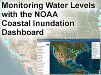
Monitoring Water Levels with the NOAA Coastal Inundation Dashboard
As sea levels change, the need to identify ongoing or forecasted coastal flooding is growing with the increased frequency of flooding. The NOAA Coastal Inundation Dashboard is a tool that informs the user about historical, current, and forecast water-levels, coastal flooding, and the associated impacts. Coastal decision makers and meteorologists can use the tool to better understand and prepare for the effects of coastal flooding and examine the increased frequency of flooding. In this lesson, learners will work through three different scenarios in which they will need to use the Dashboard to identify areas of current or predicted flooding, analyze current elevated water levels in the context of historical events, and relate water levels with on-the-ground impacts. Learners will also practice communicating this information to different parties.
-
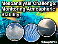
Mesoanalysis Challenge: Monitoring Atmospheric Stability
This 10-minute lesson highlights the use of the GOES-R Day Cloud Phase Distinction (DCPD) RGB to assess atmospheric stability and implications for convective development. This lesson addresses the following primary performance components from the WMO Competency Framework Satellite Skills: 3.3.2 Identify and locate convective environments and areas of instability, convective initiation, inhibition and the breakdown of inhibition.